
It’s been inspiring to learn more about the Local Place Plan programme in Scotland. I started hearing about it back in 2021, when I met with Enid Trevett of the Coalfields Regeneration Trust during COP26. Now the law of the land, Local Place Plans are community led and produced. As described in their slideshow, once the Local Place Plan is completed and registered with the local planning authority, these plans have to be taken into account by the local government when reviewing and updating their local development plan. It also has to be taken into consideration when any developer submits a planning application.
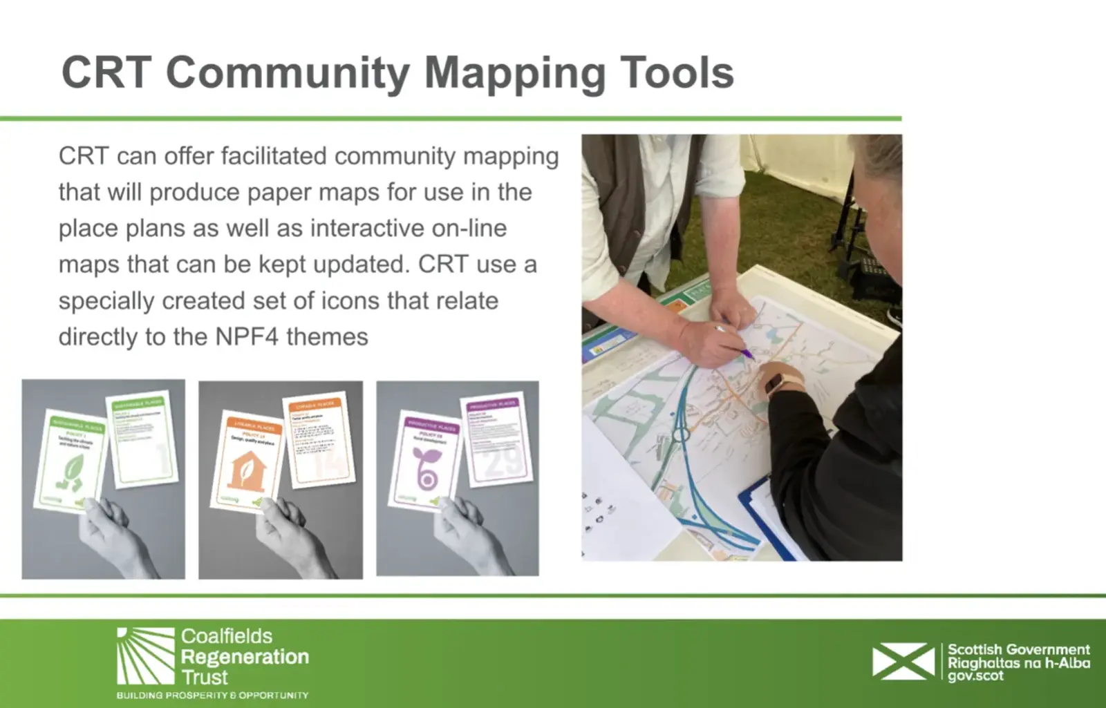
As seen in Enid's photos of Mike Trevett tabling, and Maureen, chair of the Crossgates and Mossgreen Community Council, Local Place Plans amplify the voice of the community in a meaningful way. The UN Sustainable Development Goals (the SDGs or the 'Global Goals') are key to this process as Scotland has a mandate under its Fourth National Planning Framework (NPF4) to use its 33 policies to support the Global Goals under the 3 themes of Sustainable Places, Liveable Places and Productive Places. Local Place Plans enable communities to link up with these goals at a local level and help them map out their vision for the future of their community.
Local Place Plans can include “heritage and nature conservation projects, town centre/ neighbourhood improvements, locations for climate change adaptation measures and renewables, community food growing initiatives and sites for housing development.”
Excitingly, a map is one of the three elements required, along with a framing statement and an identified community body. We’re delighted to see that a few of the Green Map Icons and our new mapping platform are central to the work by the Coalfields Regeneration Trust and already communities are on board in some of the former coal-mining areas where the CRT works, including Gorebridge - check it out here and see how this community has planned for a better future.
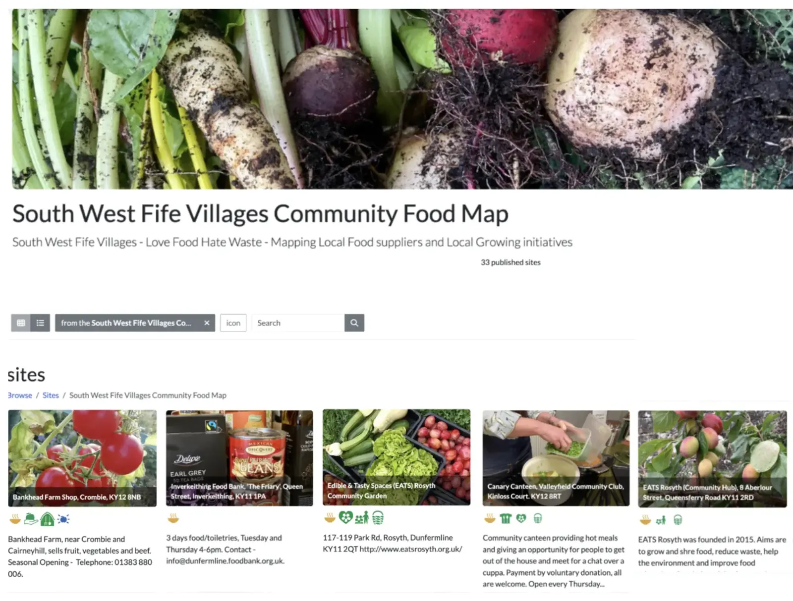
Also in Scotland, Fife Council are using the Green Map Platform interactive maps as a tool for widespread community engagement, see “A Fruit Tree for Every Garden” which is the theme of West Fife’s delightful Green Map the mapmakers had the benefit of bespoke training from our partners at GISCollective and Tacit Tacit Design.
Active with the Earth Charter and a Green Mapmaker since the 1990s, and now engaging with former coal mining communities in Central Scotland, Enid Trevett says: ‘using the Green Map icons is a great way to help people connect with their place and with national policy in a way that makes sense and connects them to the bigger picture.’


