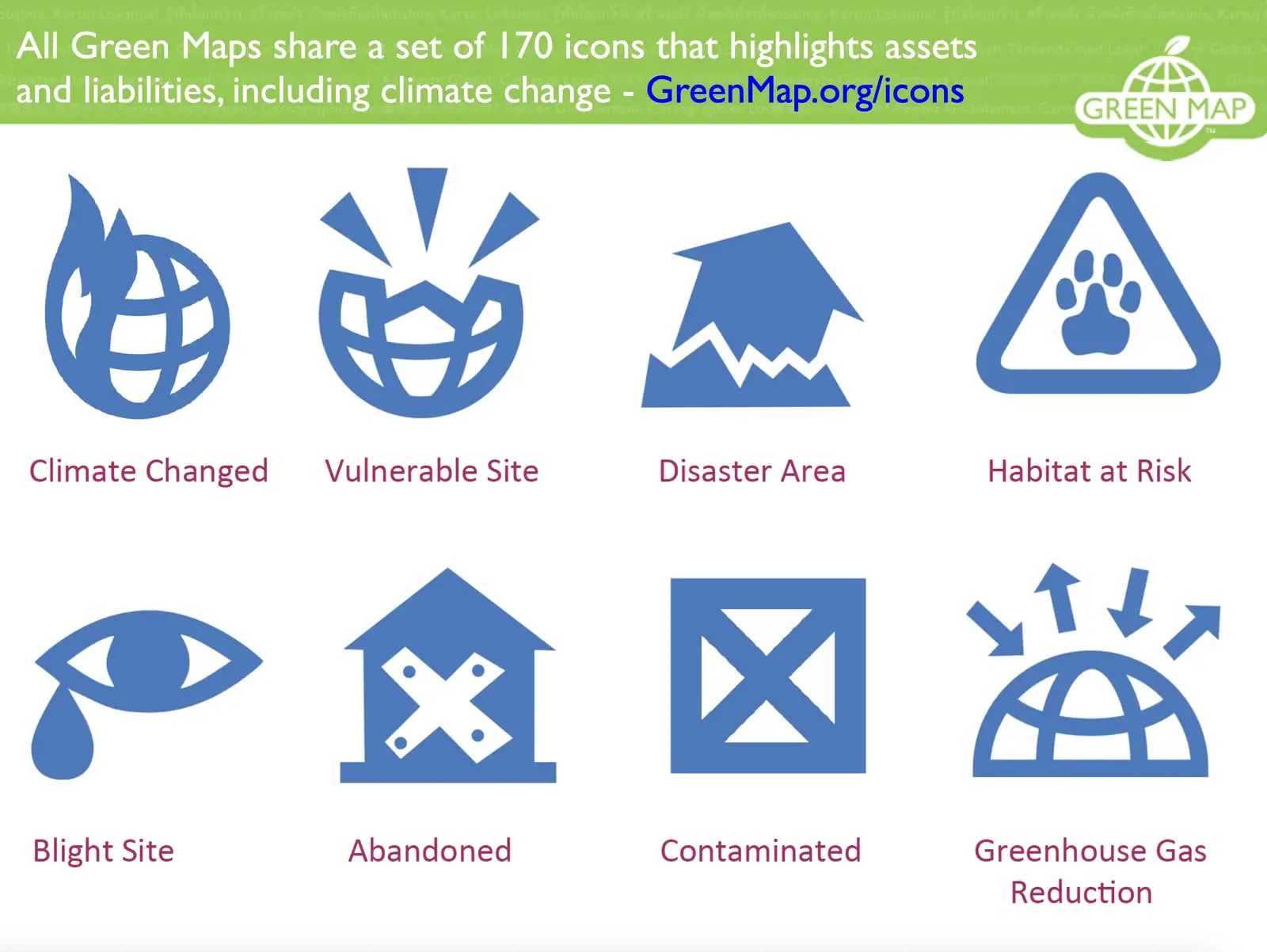
These days of war and calamity help us recall other disasters and how Green Mapmakers worked to address them. Our non-profit has been around for disasters of many kinds over the last 30 years and our work can be an antidote as getting involved locally is one sure way to lift your community out of the fog and paralysis and into action.
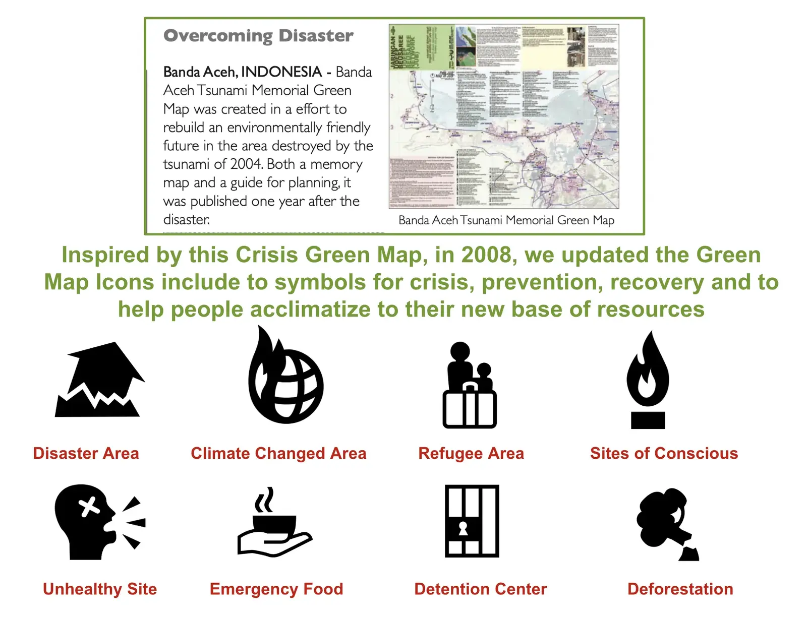
In 2011, our director gave a 5 minute talk at the Crisis Mappers conference in Geneva hosted by the humanitarian technology network, crisismapping.ning.com/. While the internet had been around a while, mapping technologies and social media were new, and were pressed into service to meet basis need as the concept of polycrisis was taking root. While the video has lost clarity since, the slides are clear, except for the images of the Banda Aceh Green Map created by Marco Kusumajiwaya and colleagues with communities devastated by the 2005 tsunami and noted in our Impacts book - GreenMap.org/impacts
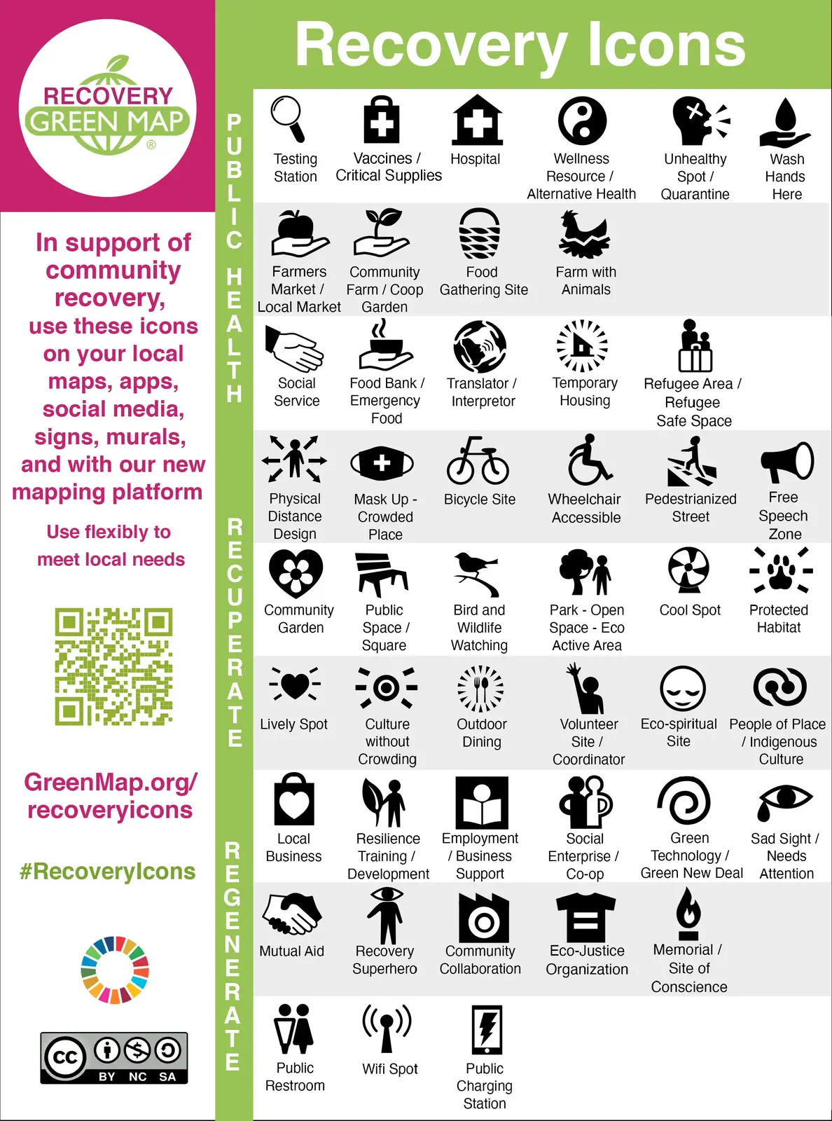
In 2020, we created the Recovery Icons that centered public health, recuperation and regeneration.
Now in 2026, do we need to extend this set to include new types of disasters? See how these were adapted by Yohei Yasuda for the 2024 International Disaster Nursing conference to include temporary and good sites. What would you add?